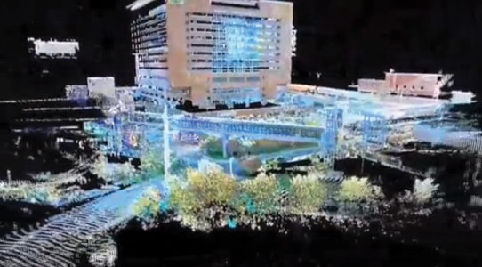
3D Laser Surveys provides commercial and industrial construction clients with high definition laser scans, drawings and models that link accurate information between architects and engineers, ultimately saving both time and money.
Our 3D high-definition scanning replaces traditional surveying methods that have historically relied on technologies that were time consuming and yielded less than precise data. Today, construction companies can use laser scanners to gather precise data on construction site terrain and other critical information for building and site modeling, renovations and additions.
3D Laser Surveys provides you with more precise data in a shorter period of time, ultimately reducing the construction costs associated with errors and retrofitting. Data models provided by high-definition scans can be used to clash against point cloud data to check the proposed design models against existing conditions and fine-tune the design prior to construction.
With 3D Laser Surveys, you can:
- Yield precise data in a shorter period of time.
- Reduced the time required for surveying.
- Obtain early measurement and verification of foundation structure.
- Reduce errors and costs.
- Grade volume calculations and verifications.
- Measure erosion.
- Verify adherence to engineering specifications.
- Verify topography after land has been cleared.
- Avoid crane collision by verifying building height measurements.
*Note that all videos are not the work of 3D Laser Surveys.

