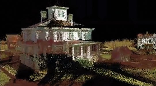
3D Laser Surveys provides the precise measurements you need to complete the pre-design phase of your architectural project whether it is adding a pedestrian bridge between two buildings, renovating a parking lot, land terrain modeling for a golf course or landscape design, or collecting environmental metrics for analysis and modeling.
Our 3D high-definition scanning replaces traditional surveying methods that are time consuming and expensive, often resulting in delayed start dates and unbudgeted costs.
We provide all electronic deliverables including 360° rotational photographs with measurable x, y and z coordinates; point clouds containing millions of registered data pints; and the ability to produce 3D computer models. Data is both cost effective and user friendly.
Models can be used to clash against point cloud data to check the proposed design models against existing conditions and fine-tune the design prior to construction. Because data can be checked and rechecked from your desktop computer after the initial scan, the number of trips to the project site is greatly reduced, as well as the number of permanent staff required to turn out a completed set of drawings.
With 3D Laser Surveys, you can:
- Yield precise data in a shorter period of time.
- Reduced the time required for surveying.
- View electronic file output in AutoCAD or MicroStation.
- View 2D and 3D drawings of building facades.
- Capture all areas of a roof, including those in need of repair, in electronic or hard copy.
- Reduce errors and costs.
- Quickly produce “fly-through” video presentations.
- Produce interior decoration modeling.
- Produce animation inside and outside 3D scans.
*Note that all videos are not the work of 3D Laser Surveys

